Cropwise IMAGERY
Cropwise™ Imagery delivers easy field monitoring anytime, anywhere — enabling retailers and growers to address and share field health issues in real time and maximize crop yield potential.
 US
US
US
US
Cropwise™ Imagery delivers easy field monitoring anytime, anywhere — enabling retailers and growers to address and share field health issues in real time and maximize crop yield potential.

Whether you’re looking to easily prioritize critical areas, promptly capture and share scouting notes and images, or to better understand the health of the fields, Cropwise Imagery allows you to monitor multiple fields from anywhere, so you’re always connected to your crops.

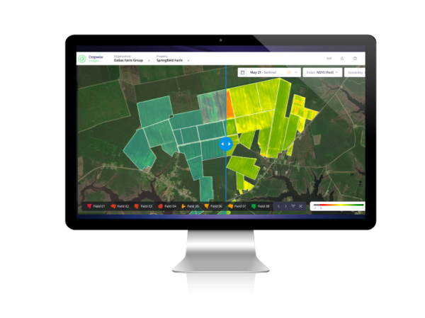
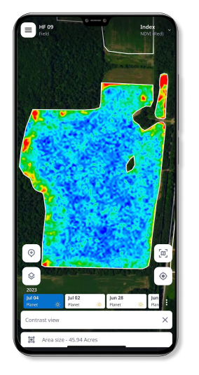
Cropwise Imagery offers scouting with a bird’s-eye view of the fields. There are frequent satellite imagery passes and easy-to-read NDVI maps to help you identify issues or field variability. Setup is easy — establish field boundaries, which can be done by importing from systems such as MyJohnDeereSM, and you’re ready to go. This tool is compatible with Cropwise Protector if you’re looking for an elevated scouting experience.

Learn what’s working and what’s driving profitability with year-over-year comparisons of all your fields. Gain insights into the efficacy of products used and quantify a lower-performing area, so you can determine if it makes sense to correct the issue. Cropwise Imagery can also help you monitor dry down and determine the order in which to harvest the fields.

Survey Geographic Database (SSURGO) maps help you avoid mismatching varieties or inputs with the wrong soil type. Variable rate prescriptions enable you to avoid over- or under-applying due to using last year’s data. If you’re a retailer, Cropwise Imagery can help you connect with your growers about what to do differently and discuss what’s working well, and you can easily store and access data from your growers’ fields at any time.
Scout on a Daily Frequency
An easy-to-read NDVI map of your fields is available every day.
Receive Historical Data
Historical data is saved in the app, helping you avoid repeating mistakes.
Track Your Fields Offline
Satellites are active even when you’re not, capturing your acres anytime.
Download Images
Download images for use offline.
Archive Satellite Imagery
Quickly load a 10-year archive of satellite imagery to help you determine what you want to do differently.
Personalize Your Dashboard
Access all your analytics in one place.
View Analytics Side-By-Side
Compare your analytics side-by-side.
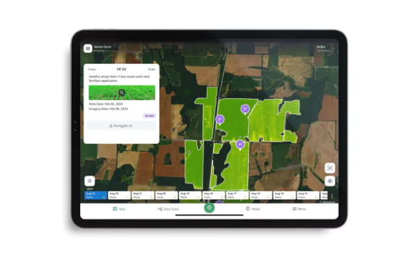
Create and Store Scouting Notes
Share and retrieve these notes later, at your convenience.